Quick answer
The two major rivers in New York City are the Hudson River and the East River. The Hudson flows 315 miles from the Adirondacks down Manhattan's west side, while the East River is actually a tidal strait connecting Long Island Sound to the harbor. Both waterways frame Manhattan Island and meet at the southern tip near Battery Park, where they merge into New York Harbor's Upper Bay.
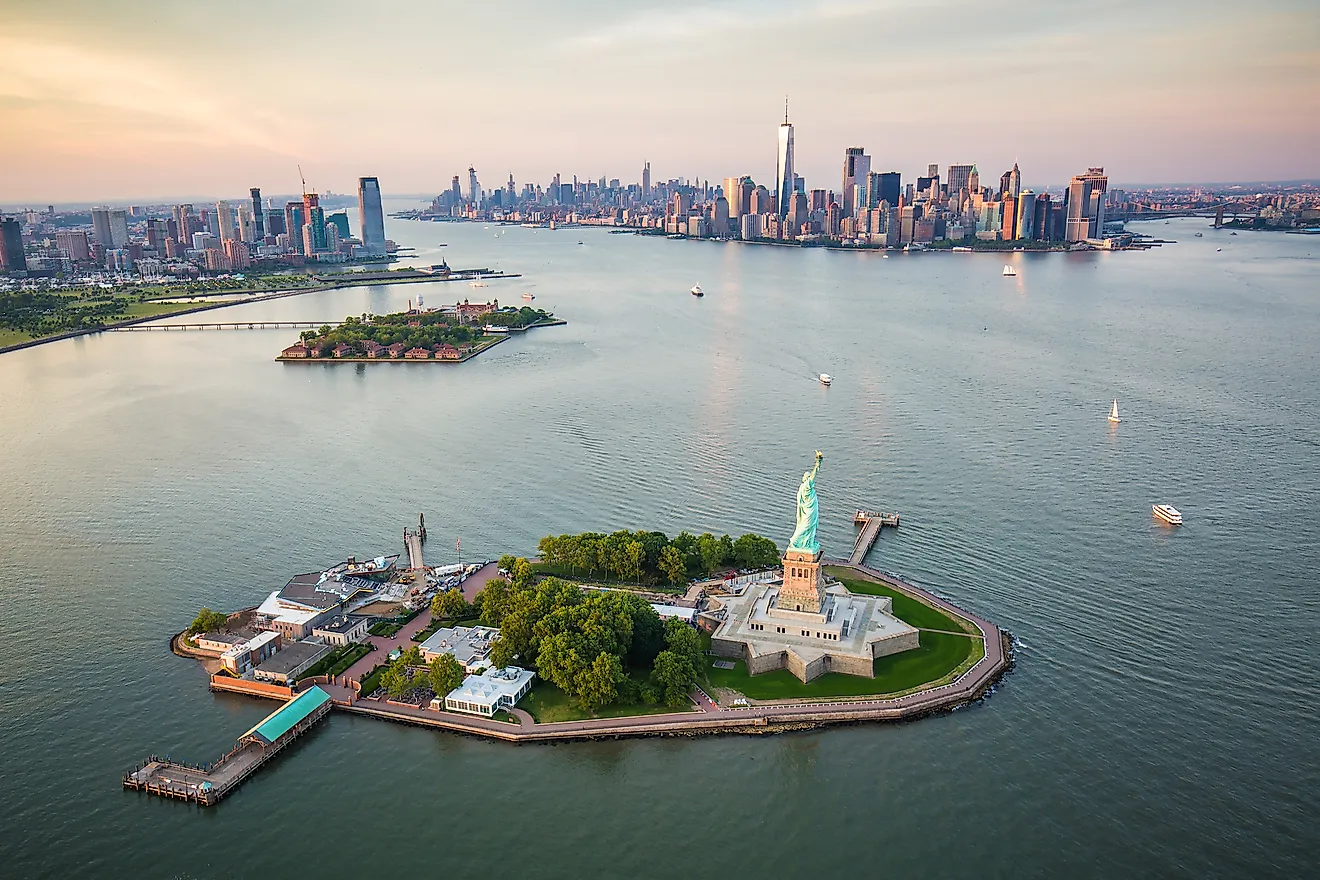
The East River is not technically a river at all. It carries no freshwater source and flows in both directions depending on tidal cycles, making it a saltwater strait that separates Manhattan from Brooklyn and Queens. The current can reach four knots during peak tidal exchange, strong enough that colonial-era mills harnessed it for power at Hell Gate, the narrow northern passage where the strait meets Long Island Sound. The Hudson River, by contrast, is a true river fed by Adirondack snowmelt and draining a 13,390-square-mile watershed. Its lower reach remains tidal as far north as Troy, 150 miles upstream, meaning the harbor's salt wedge pushes inland twice daily beneath the freshwater surface layer. This estuary dynamic supports striped bass migrations and once sustained oyster beds across the harbor floor before industrial pollution ended commercial harvests in 1927. Understanding what are the two major rivers in New York City clarifies why the harbor developed as it did. The Hudson offered a navigable corridor into the continental interior via the Erie Canal after 1825, while the East River's sheltered anchorages along the Brooklyn waterfront became the world's busiest cargo piers by the early 1900s. The confluence at the Battery remains ice-free year-round, a geographic advantage that cemented New York's role as the nation's primary Atlantic port. Today both waterways remain active shipping channels under Coast Guard jurisdiction, with designated lanes for container traffic, ferries, and recreational craft. The optimal daylight window for observing harbor activity runs from 9:00 AM to 5:00 PM, when commercial traffic peaks and visibility allows clear views of the Statue of Liberty, Governors Island, and the Verrazzano Narrows where the harbor opens to the Atlantic. Public access to the waterfront is free along both shorelines, with promenades extending from Battery Park north to the George Washington Bridge on the Hudson side and to the Queensboro Bridge along the East River.
“The East River's four-knot tidal current once powered colonial mills at Hell Gate, where the strait narrows between Manhattan and Queens.”
What Are the Two Major Rivers in New York City: Hudson vs. East River
Visitors to New York Harbor often navigate the distinct waters of the Hudson and East Rivers. Understanding the characteristics of these two waterways helps clarify the geography of the New York City waterfront.
| Hudson River Western Boundary | East River Eastern Boundary | |
|---|---|---|
| Source | Adirondack Mountains, New York | Long Island Sound and New York Harbor connection |
| Tidal Nature | Tidal estuary | Tidal strait |
| Geographic Path | Flows south to Upper New York Bay | Separates Manhattan from Long Island |
| Role in NYC Harbor | Major freshwater tributary | Primary connection between harbor and Long Island Sound |
Verdict: The Hudson River provides a broad freshwater channel into the harbor, while the East River serves as a complex tidal strait connecting the harbor to the Atlantic Ocean.
Best Time to Experience What Are the Two Major Rivers in New York City
The best arrival window is 09:00–17:00, which provides optimal daylight for viewing the Hudson and East River confluences and harbor activity. Planning your visit within this timeframe ensures clear visibility of the navigational channels and surrounding landmarks.
Weekday mornings
Low crowd density—
Early hours offer the calmest water conditions for viewing river activity.
Spring (April–May)
ModerateMild 55°F to 70°F
Temperatures are comfortable for extended observation on open decks.
Fall (September–October)
ModerateCool 55°F to 72°F
Lower humidity levels improve visibility across the harbor waters.
Verdict: Tuesday to Thursday, arriving between 09:00 and 17:00 during the months of April or October.
How to Reach the Confluence of What Are the Two Major Rivers in New York City
New York Harbor serves as the primary confluence for the Hudson and East Rivers. The area is most easily accessed via the public transit hubs located in Lower Manhattan.
1 train to South Ferry station
M15-SBS to South Ferry
Walk south via Broadway to Battery Park
NYC Ferry to Pier 11/Wall St
Admission Fees to See What Are the Two Major Rivers in New York City
Access to the public waterways that define New York Harbor, including the Hudson and East Rivers, is provided by the City of New York at no cost. There are no admission fees required to view these rivers from public vantage points.
A typical visitor pays 0 USD to access these waterways, as public observation of the river confluence is free of charge.
Hours for Viewing What Are the Two Major Rivers in New York City
The public waterways of New York Harbor, where the Hudson and East Rivers meet, are accessible daily. These hours reflect public access availability for the harbor area.
| Monday | 00:00–23:59 | Open |
|---|---|---|
| Tuesday | 00:00–23:59 | Open |
| Wednesday | 00:00–23:59 | Open |
| Thursday | 00:00–23:59 | Open |
| Friday | 00:00–23:59 | Open |
| Saturday | 00:00–23:59 | Open |
| Sunday | 00:00–23:59 | Open |
Check availability
Common Questions About New York City River Geography
Everything you need to know about what are the two major rivers in new york city